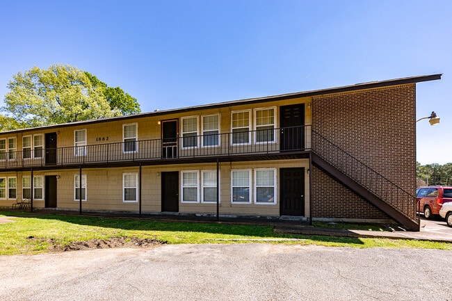
Property Record
1874 Watson Rd, Memphis, TN 38111


NEARBY LISTINGS FOR SALE OR LEASE
Property Detail
1874 Watson Rd
05-8168-0-0018C
Colony Square Apartments
Apartment
Shelby
AE
Tennessee
47157C0435F
60
2024
1.23 AC
2025
Audubon Park
007000
Memphis
9,588 SF
Memphis, TN-MS-AR
DEMOGRAPHICS near 1874 Watson Rd
1 Mile
3 Mile
5 Mile
2024 Total Population
13,838
91,782
208,704
2029 Population
13,809
91,211
207,006
Pop Growth 2024-2029
(0.21%)
(0.62%)
(0.81%)
Average Age
34
36
37
2024 Total Households
4,893
35,825
85,026
HH Growth 2024-2029
(0.06%)
(0.79%)
(0.91%)
Median Household Inc
$33,006
$42,540
$46,992
Avg Household Size
2.70
2.50
2.40
2024 Avg HH Vehicles
2.00
2.00
2.00
Median Home Value
$70,949
$130,685
$197,712
Median Year Built
1960
1963
1967
Nearby Places
Map Layers
Map Styles
 Street
 Aerial
- Restaurants
- Banks
- Shops
- Fitness
- Groceries
PUBLIC TRANSPORTATION
AIRPORT
Memphis International
DRIVE
WALK
Distance
Memphis International
12 min
7.0 mi
Freight Ports
Port of Shreveport
DRIVE
WALK
Distance
Port of Shreveport
414 min
377.5 mi
SALE & LEASE HISTORY
LISTING DATE
SALE/LEASE

Apr 26, 2023
For Sale
Nearby Properties
Address
Land Use
TOTAL SIZE
Lot Size
Zoning
Address
Land Use
TOTAL SIZE
Lot Size
Zoning
189,536 SF
49.14 AC
CMU-2
Address
Land Use
TOTAL SIZE
Lot Size
Zoning
237,911 SF
21.38 AC
EMP
Address
Land Use
TOTAL SIZE
Lot Size
Zoning
286,167 SF
18.91 AC
R-10
Address
Land Use
TOTAL SIZE
Lot Size
Zoning
190,263 SF
6.59 AC
R-10
Address
Land Use
TOTAL SIZE
Lot Size
Zoning
24.72 AC
R-10
Address
Land Use
TOTAL SIZE
Lot Size
Zoning
2,847.82 AC
EMP
Address
Land Use
TOTAL SIZE
Lot Size
Zoning
269,022 SF
23.76 AC
RU-3
Address
Land Use
TOTAL SIZE
Lot Size
Zoning
188,458 SF
29.19 AC
RU-3
Address
Land Use
TOTAL SIZE
Lot Size
Zoning
206,186 SF
13.64 AC
CMU-2
Address
Land Use
TOTAL SIZE
Lot Size
Zoning
123,976 SF
10.31 AC
CMU-3
Address
Land Use
TOTAL SIZE
Lot Size
Zoning
81,454 SF
EMP
Address
Land Use
TOTAL SIZE
Lot Size
Zoning
58.21 AC
R-6
Address
Land Use
TOTAL SIZE
Lot Size
Zoning
100,182 SF
9.39 AC
CMU-3
Address
Land Use
TOTAL SIZE
Lot Size
Zoning
300,702 SF
14.40 AC
RU-3
Address
Land Use
TOTAL SIZE
Lot Size
Zoning
15,370 SF
18.69 AC
RU-3
Address
Land Use
TOTAL SIZE
Lot Size
Zoning
55,250 SF
7.15 AC
CMU-3
Address
Land Use
TOTAL SIZE
Lot Size
Zoning
129 AC
CMP-1
Address
Land Use
TOTAL SIZE
Lot Size
Zoning
181.02 AC
R-15
Address
Land Use
TOTAL SIZE
Lot Size
Zoning
1,012,609 SF
38.67 AC
IH
Address
Land Use
TOTAL SIZE
Lot Size
Zoning
200,040 SF
12 AC
R-10
Address
Land Use
TOTAL SIZE
Lot Size
Zoning
274,100 SF
7.79 AC
CMU-3
Address
Land Use
TOTAL SIZE
Lot Size
Zoning
369,190 SF
23.75 AC
EMP
Address
Land Use
TOTAL SIZE
Lot Size
Zoning
671,940 SF
29.38 AC
EMP
Address
Land Use
TOTAL SIZE
Lot Size
Zoning
173,089 SF
10.92 AC
EMP
Address
Land Use
TOTAL SIZE
Lot Size
Zoning
71,308 SF
EMP
Address
Land Use
TOTAL SIZE
Lot Size
Zoning
138,881 SF
9.91 AC
CMU-2
Address
Land Use
TOTAL SIZE
Lot Size
Zoning
66,841 SF
7.86 AC
CMU-3
Address
Land Use
TOTAL SIZE
Lot Size
Zoning
62,022 SF
6.28 AC
EMP
Address
Land Use
TOTAL SIZE
Lot Size
Zoning
149,710 SF
3.61 AC
OG
Address
Land Use
TOTAL SIZE
Lot Size
Zoning
106,792 SF
8.85 AC
CMU-2
The World's #1 Commercial Real Estate Marketplace
Connect with us
© 2026 CoStar Group
The information above has been obtained from sources believed reliable. While we do not doubt its accuracy we have not verified it and make no guarantee, warranty or representation about it. It is your responsibility to independently confirm its accuracy and completeness. Any projections, opinions, assumptions, or estimates used are for example only and do not represent the current or future performance of the property. The value of this transaction to you depends on tax and other factors which should be evaluated by your tax, financial, and legal advisors. You and your advisors should conduct a careful, independent investigation of the property to determine to your satisfaction the suitability of the property for your needs.